Add your own picture and explain the route, parking, gates, paths or landmarks that help people find it.
Earn 5 points after the picture is checked and accepted.
Add your photo and local directionsShare what you foundWhat is recorded here
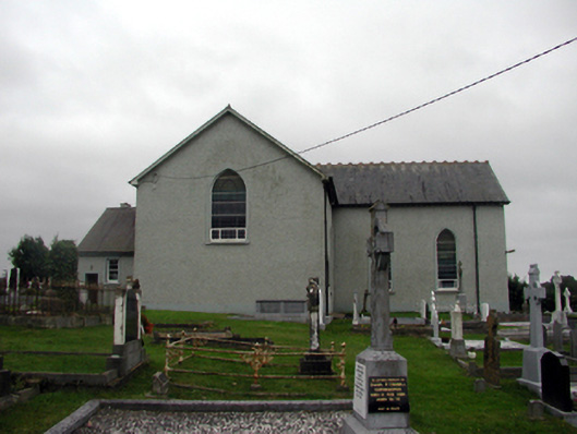
Detached four-bay double-height Catholic church, built 1827, on a cruciform plan comprising two-bay double-height nave with single-bay double-height transepts to north and to south, single-bay double-height shallow chancel to east, and two-bay single-storey sacristy to east. Renovated, c.1930. Pitched slate roofs with decorative red clay ridge tiles, roughcast chimney stack to sacristy, and cast-iron rainwater goods on rendered eaves. Painted replacement roughcast walls, c.1930, over random rubble stone construction. Pointed-arch window openings (lancet window openings to chancel) with stone sills, and rendered surrounds. Fixed-pane leaded stained glass windows with casement sections. Pointed-arch door openings with cut-limestone chamfered surrounds having hood mouldings over, and tongue-and-groove timber panelled doors with decorative wrought iron hinges. Square-headed window openings to sacristy with rendered sills, rendered surrounds, and replacement 2/2 timber sash windows, c.1930, having horizontal bias to panes. Square-headed door opening to sacristy with tongue-and-groove timber panelled door, and overlight. Full-height interior open into roof with carved timber pews, open work timber roof construction (with coffering to ceiling) on cut-stone corbels having trefoil-headed pierced detailing, Gothic-style reredos to chancel, ogee-headed arcades to transepts with moulded plasterwork surrounds on limestone ashlar polygonal piers, hood mouldings over, and timber panelled galleries to first floor to nave and transepts on cast-iron pillars. Set back from road in own grounds with random rubble stone boundary wall to perimeter of site having cut-stone coping, sections of wrought iron railings over, and rendered intermediary piers. (ii) Graveyard to site with various cut-stone grave markers, c.1830 - present.
This official record and map point do not grant access. Most recorded buildings are privately owned; view them only from public ground unless the owner allows entry.