Add your own picture and explain the route, parking, gates, paths or landmarks that help people find it.
Earn 5 points after the picture is checked and accepted.
Add your photo and local directionsShare what you foundWhat is recorded here
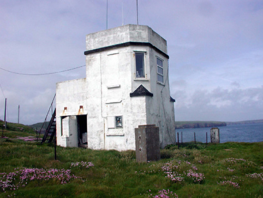
Freestanding single-bay two-storey flat-roofed pilot station, c.1940, on a square plan with single-bay two-storey side elevations, single-bay single-storey flat-roofed end bay to north-east, and single-bay single-storey flat-roofed entrance bay/return to north-west. Refenestrated, c.1990. Flat concrete roofs not visible behind parapets with rendered chimney stack, and iron rainwater goods. Painted cement rendered walls over red brick irregular bond brick construction with chamfered corners to first floor, rendered stringcourses to parapets, and rendered coping. Square-headed window openings with concrete sills. Replacement uPVC casement windows, c.1990, with some openings now blocked-up. Square-headed door openings with glazed timber doors. Set on cliff top with natural grounds to site.
This official record and map point do not grant access. Most recorded buildings are privately owned; view them only from public ground unless the owner allows entry.