Add your own picture and explain the route, parking, gates, paths or landmarks that help people find it.
Earn 5 points after the picture is checked and accepted.
Add your photo and local directionsShare what you foundWhat is recorded here
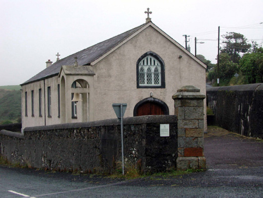
Detached six-bay double-height temperance hall, built 1842. Renovated and extended, 1854, comprising four-bay double-height lean-to lower parallel range to east, and single-bay double-height lower chancel to north having single-bay single-storey lean-to sacristy to north-east to accommodate use as Catholic church. Mostly refenestrated, pre-1999. Pitched slate roofs (lean-to to parallel range and to sacristy) with clay ridge tiles, roughcast chimney stack, cross finials to apexes, and replacement uPVC rainwater goods, pre-1999, on timber eaves. Painted roughcast walls. Square-headed window openings to nave with stone sills, and replacement uPVC casement windows, pre-1999. Pointed-arch window openings to north and to south with cut-stone surrounds having chamfered reveals. Fixed-pane timber windows in tripartite arrangement having lancet-lights, and diamond-leaded fittings. Four centred-arch door opening with cut-stone surround, and replacement tongue-and-groove timber panelled double doors, pre-1999. Full-height interior open into roof with carved timber pews, open timber roof construction, and carved timber fittings to chancel (including communion rail, pulpit, and altar). Set back from line of road in own grounds on a wedge-shaped site parallel to roads with tarmacadam grounds to site. Gateway, 1842, to south comprising pair of cut-stone piers with profiled capping, and random rubble stone boundary wall to perimeter.
This official record and map point do not grant access. Most recorded buildings are privately owned; view them only from public ground unless the owner allows entry.