Add your own picture and explain the route, parking, gates, paths or landmarks that help people find it.
Earn 5 points after the picture is checked and accepted.
Add your photo and local directionsShare what you foundWhat is recorded here
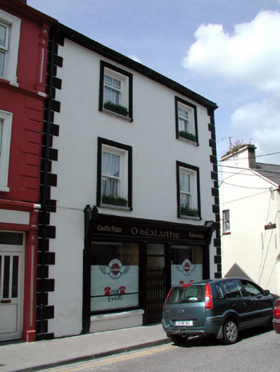
End-of-terrace two-bay three-storey house, c.1855, on an L-shaped plan on a corner site retaining some early fenestration with two-bay three-storey side elevation to east, and three-bay three-storey lower return to north. Renovated, c.1905, with shopfront inserted to ground floor, and single-bay single-storey canted oriel window added to side (east) elevation. Part refenestrated, post-1999. Pitched slate roofs with clay ridge tiles, red brick Running bond chimney stacks, rendered coping, and cast-iron rainwater goods on rendered eaves. Painted rendered wall to front (south-east) elevation with rendered quoins to corners. Unpainted rendered walls to remainder with unpainted lime rendered walls to rear (north) elevation. Square-headed window openings (including to canted oriel window on rendered base) with stone sills, and moulded rendered surrounds to front (south-east) elevation. Replacement 2/2 uPVC sash windows, post-1999, to front (south-east) elevation with early 2/2 timber sash windows to remainder (1/1 timber sash windows to canted oriel window). Timber shopfront, c.1905, to ground floor with pilasters, fixed-pane timber display windows, glazed timber panelled double doors with overlight, wrought iron gate to front, timber fascia over having consoles, and moulded cornice. Round-headed door opening to side (east) elevation with timber panelled door, and overlight. Road fronted on a corner site with concrete brick cobbled footpath to front.
This official record and map point do not grant access. Most recorded buildings are privately owned; view them only from public ground unless the owner allows entry.