Add your own picture and explain the route, parking, gates, paths or landmarks that help people find it.
Earn 5 points after the picture is checked and accepted.
Add your photo and local directionsShare what you foundWhat is recorded here
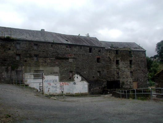
Detached five-bay four-storey rubble stone corn mill, c.1800, on a cranked plan with two-bay four-storey lower end bay to north-west. Now disused and part derelict. Pitched slate roofs with clay ridge tiles, cut-stone coping, and traces of cast-iron rainwater goods on cut-stone eaves. Random rubble stone walls with lime mortar, and section of slate hanging to rear (south) elevation. Square-headed window openings with no sills, and rubble stone and red brick voussoirs. Traces of timber fittings. Square-headed door openings with rubble stone voussoirs, and remains of timber fittings. Segmental-headed integral arch over mill race with rubble stone voussoirs, and squared rubble stone soffits having traces of lime render over. Set back from road in own grounds with overgrown grounds to site.(ii) Remains of detached three-bay two-storey rubble stone outbuilding, c.1800, to north-west. Now in ruins. Pitched roof now gone with no rainwater goods surviving on squared rubble stone eaves. Random rubble stone walls (now partly collapsed) with lime mortar. Openings not discernible.(iii) Mill race, c.1800, to site retaining fragments of original mechanisms.(iv) Gateway, c.1850, to south comprising pair of unpainted rendered piers with wrought iron gate having sections of wrought iron flanking railings on rendered plinth wall, and rendered terminating piers.
This official record and map point do not grant access. Most recorded buildings are privately owned; view them only from public ground unless the owner allows entry.