Add your own picture and explain the route, parking, gates, paths or landmarks that help people find it.
Earn 5 points after the picture is checked and accepted.
Add your photo and local directionsShare what you foundWhat is recorded here
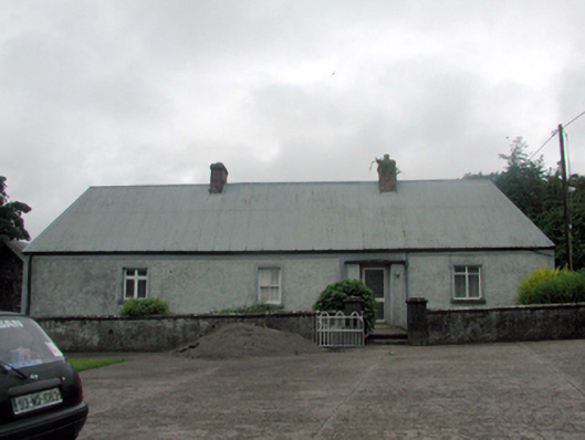
Detached four-bay single-storey house, c.1820, originally thatched. Renovated and extended, c.1920, comprising two-bay single-storey return to north-east. Reroofed, c.1970. Hipped roof with replacement corrugated-galvanised metal, c.1970, over original thatch, iron ridge tiles, red brick Running bond chimney stacks, and cast-iron rainwater goods on rendered eaves. Hipped slate roof to return with clay ridge tiles. Painted replacement roughcast walls, c.1920, with rendered strips, and band to eaves. Square-headed window openings with rendered sills and surrounds. Replacement 2/2 timber sash windows, c.1920, with one replacement timber casement windows, c.1970. Square-headed door opening with rendered surround, and replacement glazed aluminium door, c.1970. Set back from line of road in own grounds on a quasi corner site with forecourt having roughcast boundary wall to perimeter, and side (east) elevation fronting on to road. (ii) Detached two-bay single-storey rubble stone outbuilding, c.1870, to north. Reroofed, c.1945. Pitched roof with replacement corrugated-iron, c.1945, iron ridge tiles, and rendered coping. Random rubble stone walls with lime mortar. Openings not visible. (iii) Detached two-bay single-storey rubble stone outbuilding, c.1870, to north with pair of segmental-headed carriageways. Pitched slate roof with clay ridge tiles, and rendered coping. Random rubble stone wall with lime mortar. Pair of segmental-headed carriageways with painted red brick ‘voussoirs’, and no fittings.
This official record and map point do not grant access. Most recorded buildings are privately owned; view them only from public ground unless the owner allows entry.