Add your own picture and explain the route, parking, gates, paths or landmarks that help people find it.
Earn 5 points after the picture is checked and accepted.
Add your photo and local directionsShare what you foundWhat is recorded here
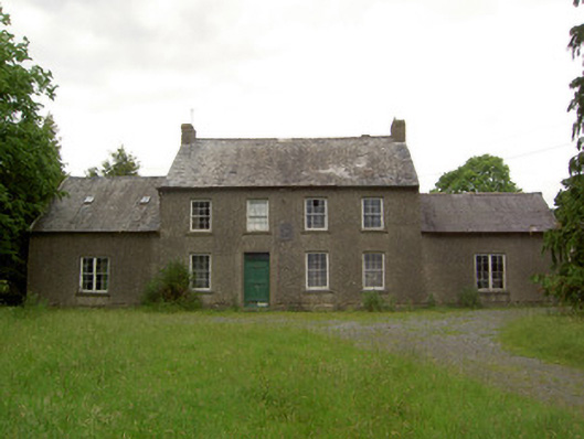
Detached four-bay two-storey house, dated 1648, having slightly lower two-bay two-storey block to rear. Altered c.1730, refenestrated, and provided with flanking single-bay single-storey with attic wings. Pitched slate roofs with ridge tiles, rendered end chimneystacks to main block, red brick to rear block, and cast-iron rainwater goods. Pebbledashed walls with carved limestone armorial plaque to front façade and having large blocky limestone quoins to north-east corner of main block. Square-headed window openings with timber-sliding box sash windows to main block, six-over-six pane to front and first floor of rear and two-over-two pane to ground floor, double four-over-four pane to front of wings, and three-over-six and two-over-two pane to rear block, most with cut limestone sills. Square-headed door opening, asymmetrically placed, with timber panelled door and overlight. Window shutters to interior. Yard of outbuildings to rear. West range comprising three-bay two-storey block with pitched slate roof and rubble limestone walls with square-headed window and door openings and with slightly higher six-bay two-storey block to north having barrel-profile corrugated-iron roof with segmental-arched entrances to ground floor. Shorter single-storey blocks to north side of yard with rendered walls and pitched corrugated-iron roof. East range comprises single-storey block with pitched slate roof, part rendered rubble limestone walls and segmental-arched carriage entrances. Walled garden to east of house and yard.
This official record and map point do not grant access. Most recorded buildings are privately owned; view them only from public ground unless the owner allows entry.