Add your own picture and explain the route, parking, gates, paths or landmarks that help people find it.
Earn 5 points after the picture is checked and accepted.
Add your photo and local directionsShare what you foundWhat is recorded here
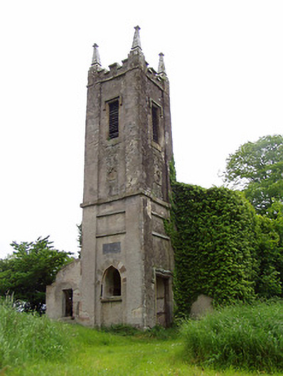
Freestanding Board of First Fruits style church, having three-bay nave built 1825 on site of medieval church which had been renovated 1720, with two-stage tower to west built 1797. Closed 1949, dismantled 1963-4, now roofless. Pitched roof, structure and covering missing. Carved crenellations and pyramidal pinnacles to tower. Roughcast rendered slate-hung rubble limestone and sandstone walls, having corner pilasters to tower, with string courses to lower stage between pilasters, sandstone string course between stages and eaves course to top. Carved limestone date plaque to west elevation of tower. Pointed arch windows to nave, having remains of timber window frames with cut-stone internal sills, two-light to long walls and traceried three-light to east gable. Carved sandstone quatrefoil motifs and square-headed window openings to upper stage of tower, latter with carved sandstone label-mouldings, some with shutters. Pointed arch window opening to west elevation of tower, with voussoirs of alternately-coloured stones and limestone sill. Entrance to south elevation of tower comprises square-headed opening with carved limestone label-moulding and chamfered surround. Church stands within graveyard. Tomb to Hamerton family in graveyard. Roofless lean-to single-storey outbuilding with rendered stone walls attached to west wall of graveyard. Snecked sandstone piers with double-leaf cast-iron gates, stile and rubble sandstone boundary walls.
This official record and map point do not grant access. Most recorded buildings are privately owned; view them only from public ground unless the owner allows entry.