Add your own picture and explain the route, parking, gates, paths or landmarks that help people find it.
Earn 5 points after the picture is checked and accepted.
Add your photo and local directionsShare what you foundWhat is recorded here
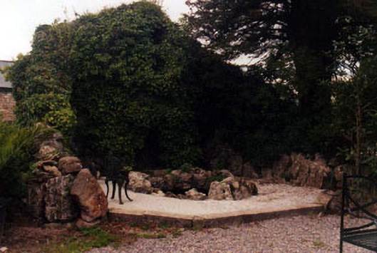
Group of garden structures, erected c.1835, and associated with Kilshane House. Grotto to north-west of house comprising semic-circular plan wall of limestone boulders having irregular-plan cavern to front with walling and roofing of limestone boulders. Path to south lined with limestone boulders and having steps up to cross bridge over narrow avenue leading to farmyards and stableyards, from main road to south. Bridge has coursed limestone walling and dressed voussoirs to segmental arch. Path over bridge terminated by decorative cast-iron double-leaf pedestrian gate. Short flight of cut limestone steps opposite front elevation of country house leads up to parkland and has low curved parapets and low piers of single blocks. Longer flight of steps with similar parapets leads from parkland to line up with arched entranceway to stableyard.
This official record and map point do not grant access. Most recorded buildings are privately owned; view them only from public ground unless the owner allows entry.