Add your own picture and explain the route, parking, gates, paths or landmarks that help people find it.
Earn 5 points after the picture is checked and accepted.
Add your photo and local directionsShare what you foundWhat is recorded here
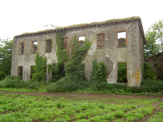
Detached seven-bay two-storey over basement house, built c.1820, now in state of ruin. Presents two storeys to front and three to rear and has two-bay end elevations. Roofless with cut limestone corbel table to eaves and having red brick chimneystacks. Roughcast rendered rubble limestone walls with red brick internal masonry and render quoins. Square-headed window openings with brick surrounds and limestone sills. Tall round-headed window to middle of rear elevation. Some blocked segmental-arched openings to west end of rear. Remains of doorcase with limestone Doric engaged column, with steps. Seven-bay and five-bay ranges of two-storey outbuildings to rear of house with pitched slate roofs, rendered chimneystacks, limestone corbel tables and rendered and painted walls with double timber casement windows and round-headed pedestrian and elliptical-headed vehicular entrances. Flat-headed carriageway through middle of smaller range with recessed round-headed panel overhead occupying first floor and having keystone.
This official record and map point do not grant access. Most recorded buildings are privately owned; view them only from public ground unless the owner allows entry.