Add your own picture and explain the route, parking, gates, paths or landmarks that help people find it.
Earn 5 points after the picture is checked and accepted.
Add your photo and local directionsShare what you foundWhat is recorded here
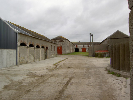
Yard of outbuildings, built c.1870, accompanying now demolished Kingswell House. Random rubble limestone boundary walls having segmental arched entrance gateway of ashlar limestone with imposts and coping surmounted by elaborate ashlar bellcote with carved limestone volutes and round-arched bellcote supporting a carved limestone eagle. Extensive ranges of outbuildings having U-plan yard at north end of complex with hipped slate roofs and roughcast rendered walls with segmental brick arched carriage entrances with render keystones. Seven-bay single-storey outbuilding with rendered piers supporting arches and L-plan two-storey outbuildings with brick chimneys. Triple-pile lofted single-storey outbuildings to south-west with pitched slate roofs and rendered walls.
This official record and map point do not grant access. Most recorded buildings are privately owned; view them only from public ground unless the owner allows entry.