Add your own picture and explain the route, parking, gates, paths or landmarks that help people find it.
Earn 5 points after the picture is checked and accepted.
Add your photo and local directionsShare what you foundWhat is recorded here
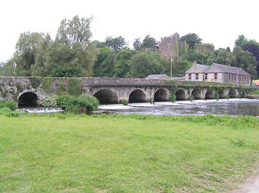
Thirteen-arch road bridge over River Suir, rebuilt c. 1800, showing evidence of widening to east elevation, but likely to incorporate medieval and/or seventeenth-century fabric. Irregular arches, varying between round and segmental and of varying heights, with cut-stone V-cutwaters to west elevation. Three dry round overflow arches to south end, and segmental arch over millstream to east side of north end. Rubble limestone walls with cut limestone voussoirs, rendered soffits, rubble limestone parapet walls with flat capstones, render coping to south end of west parapet, and rectangular drainage holes with lintels to carriageway. Large pipe carried across east elevation.
This official record and map point do not grant access. Most recorded buildings are privately owned; view them only from public ground unless the owner allows entry.