Add your own picture and explain the route, parking, gates, paths or landmarks that help people find it.
Earn 5 points after the picture is checked and accepted.
Add your photo and local directionsShare what you foundWhat is recorded here
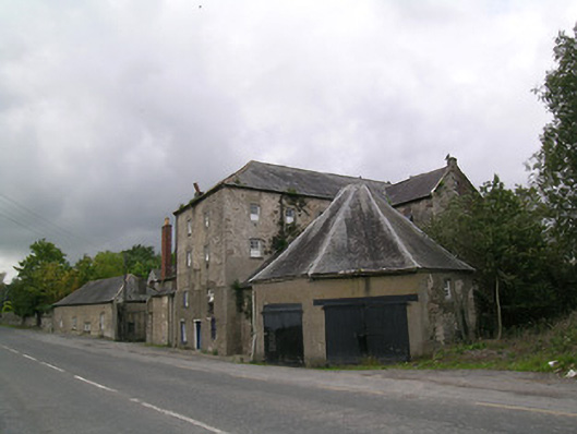
Detached mill complex, built c. 1800, comprising seven-bay four-storey L-plan block with attic, having seven-bay four-storey block attached to south-west, octagonal structure added c. 1860 to north-east, two-storey dwelling to south, two-pile two-storey building with attic to south-west and four-bay single-storey block to front of site at south. Hipped slate roofs to road gable of L-plan block and to single-storey and two-storey front blocks, pitched slate elsewhere, with red brick chimneystacks and cast-iron rainwater goods and with rooflights and eaves course to main block. Octagonal pyramidal roof to octagonal building, with lead flashing. Roughcast rendered random rubble stone walls to main blocks and to two-storey blocks at south-west, coursed snecked stone to single-storey front block. Square-headed timber sliding sash windows to four-storey blocks, with mainly six-pane upper lifts over boarded lower, with some eight-pane upper lifts. Fixed timber frame and timber casement elsewhere, with replacement uPVC windows to dwelling and brick surrounds to two-storey south-west blocks. Square-headed door openings, having timber battened door with round-headed glazed panels to road gable of main block, and timber battened double-leaf doors to octagonal structure. Timber plank chute to first floor of road gable. River Suir flows past rear of complex.
This official record and map point do not grant access. Most recorded buildings are privately owned; view them only from public ground unless the owner allows entry.