Add your own picture and explain the route, parking, gates, paths or landmarks that help people find it.
Earn 5 points after the picture is checked and accepted.
Add your photo and local directionsShare what you foundWhat is recorded here
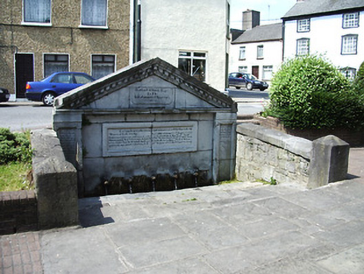
Freestanding well, dated 1833, with boundary wall and steps to main elevation. Coursed limestone wall to main elevation with pediment, moulded cornice, dentils, and panelled pilasters. Series of animal heads spouting water into stone trough. Carved limestone commemorative panel to pediment. Further plaque to pediment and inscriptions to tops of pilasters, all with biblical texts. Dressed coursed stone facing to rear elevation, with metal cramps joining both faces together. Random rubble stone side boundary walls with dressed limestone copings and piers.
This official record and map point do not grant access. Most recorded buildings are privately owned; view them only from public ground unless the owner allows entry.