Add your own picture and explain the route, parking, gates, paths or landmarks that help people find it.
Earn 5 points after the picture is checked and accepted.
Add your photo and local directionsShare what you foundWhat is recorded here
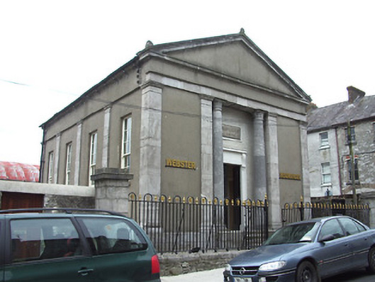
Detached temple-style single-storey structure, dated 1844, with four-bay side elevations and having single-storey twentieth-century extension to rear. Formerly church and parish hall, now in use as offices. Pitched roof, covering not visible, to main block and pitched slate to extension, with cast-iron rainwater goods. Acroteria to east gable, rendered chimneystack to west. Pediment to front elevation with moulded limestone cornices, with rendered tympanum and frieze, and having coursed dressed limestone to cornice at east elevation. Rendered walls with cut limestone pilasters to all elevations and between windows of side elevations, having moulded capitals and bases. Coursed dressed limestone plinth. Square-headed window openings to side elevations with timber sliding sash nine-over-six pane windows, having dressed limestone sills. Recessed entrance bay to front elevation, flanked by stone columns with stylised leaf capitals, and having date plaque reading 'Scots Church A.D. 1844'. Square-headed entrance opening with painted rendered doorcase, having moulded canopy supported on fluted brackets, with plinth blocks and timber panelled double-leaf door, accessed by flight of limestone steps. Wrought and cast-iron railings and gate to front boundary on moulded limestone plinth and having dressed limestone piers to ends with carved limestone caps. Random rubble stone wall with rendered coping to north elevation.
This official record and map point do not grant access. Most recorded buildings are privately owned; view them only from public ground unless the owner allows entry.