Add your own picture and explain the route, parking, gates, paths or landmarks that help people find it.
Earn 5 points after the picture is checked and accepted.
Add your photo and local directionsShare what you foundWhat is recorded here
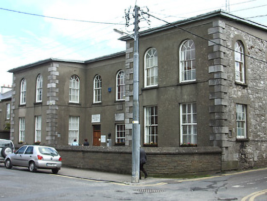
Detached U-plan two-storey former school, dated 1842, with projecting two-bay ends flanking three central bays and three-bay side elevations, now in use as community centre. Low pitched roof, covering not visible, with rendered chimneystacks, cast-iron rainwater goods and rendered eaves course. Rendered walls to front elevation, ruled-and-lined, with date plaque to central bay, snecked limestone walls elsewhere, with dressed limestone quoins and plinth course. Round-headed window openings to first floor with stone sills and timber sliding sash three-over-six pane windows. Square-headed window openings to ground floor with stone sills and timber sliding sash six-over-six pane windows, six-over-three panes to central bay. Square-headed entrance openings to centre end bays, with replacement timber panelled double-leaf doors, and plain overlights. Block-and-start surrounds to openings on south elevation and dressed limestone voussoirs to rear openings. Coursed rock-faced capped low boundary wall to front elevation, high random rubble stone boundary wall to rear.
This official record and map point do not grant access. Most recorded buildings are privately owned; view them only from public ground unless the owner allows entry.