Add your own picture and explain the route, parking, gates, paths or landmarks that help people find it.
Earn 5 points after the picture is checked and accepted.
Add your photo and local directionsShare what you foundWhat is recorded here
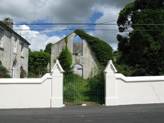
Freestanding T-plan gable-fronted double-height Roman Catholic church, dated 1837, now ruinous. Comprising two-bay nave with two-bay transepts to sides (north, south) and single-bay single-storey sacristy to rear (east). Pitched roofs now absent with rendered rubble stone eaves course. Rendered rubble stone walls with tooled limestone date plaque to front (west) elevation. Pointed arch window openings with stone sills, having occasional remains of timber Y-tracery with four-over-six pane timber sliding sash windows surmounted by multiple-pane overlights throughout. Elliptical-headed door opening to front elevation of nave, having double-leaf timber battened doors surmounted by timber battened tympanum. Later bell tower to north-west having lined-and-ruled rendered walls with camber-headed arch. Rendered enclosing walls with square-profile piers comprising of rendered plinth and pitched render capping with decorative ridge finial supporting double-leaf wrought-iron gates.
This official record and map point do not grant access. Most recorded buildings are privately owned; view them only from public ground unless the owner allows entry.