Add your own picture and explain the route, parking, gates, paths or landmarks that help people find it.
Earn 5 points after the picture is checked and accepted.
Add your photo and local directionsShare what you foundWhat is recorded here
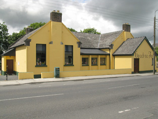
Detached five-bay double-height former boys' national school, dated 1913. Having two-bay gable-fronted traversing blocks to sides (north, south), having two-bay single-storey extension to front of northern traversing block. Later three-bay single-storey lean-to extension to front of main block. Lean-to porches to side elevations (north and south) and two-bay single-storey extension to rear (west) of main block. Pitched slate and artificial slate roofs, having render gable copings on tooled limestone impost blocks to traversing block gables. Rendered and red brick chimneystacks, uPVC rainwater goods and recent roof lights. Rendered walls throughout. Square-headed window openings with tooled limestone throughout with occasional render replacement sills, having replacement timber and uPVC casement windows. Recent iron-mesh window guards and iron-bar window guards to rear elevation openings. Square-headed door openings with tooled limestone stepped approaches to front elevation of porch (south) and rear (west) elevation of rear extension, having replacement timber battened doors. Timber panelled door to rear elevation of porch to side (north). Three-bay single-storey single pitched outbuilding to rear. Rendered enclosing wall with render coping, square-profile piers, capping and sliding metal boom to northern entrance. Situated within own grounds overlooking Straid Nua.
This official record and map point do not grant access. Most recorded buildings are privately owned; view them only from public ground unless the owner allows entry.