Add your own picture and explain the route, parking, gates, paths or landmarks that help people find it.
Earn 5 points after the picture is checked and accepted.
Add your photo and local directionsShare what you foundWhat is recorded here
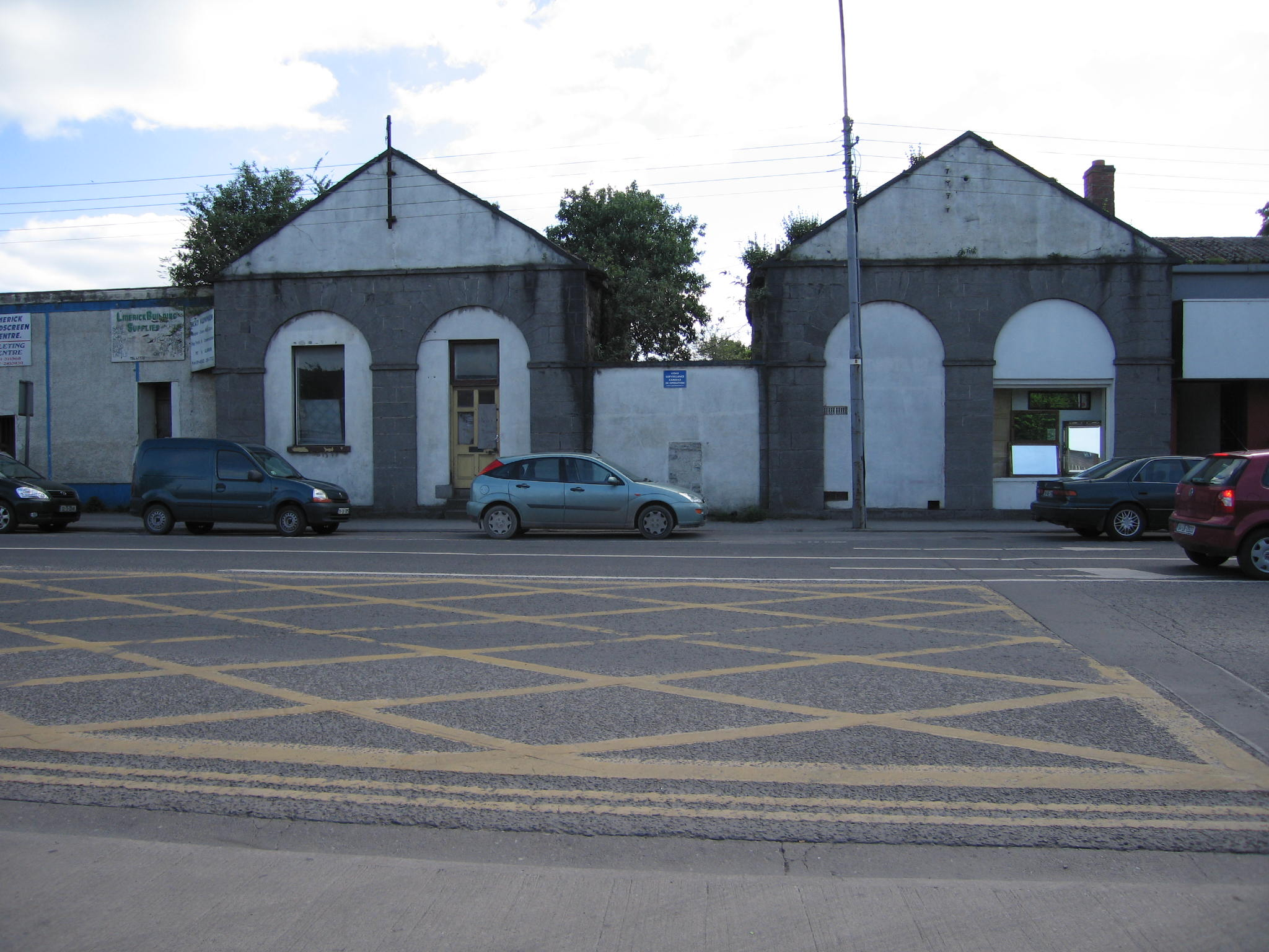
Pair of detached gatehouses, built in 1807, forming part of the artillery barracks. Each is linked by rendered screen wall, c. 1950, but formerly flanked entrance. Each elevation forming a symmetrical pair of gabled-fronted elevations with limestone ashlar twin arcade to ground floor. Arcaded limestone ashlar barrack elevations with brick-faced oculus to rubble limestone pediment, with later openings and accretions, dating to mid twentieth century. Pitched slate roof to both structures. To all sides arched openings are blocked-up and rendered or glazed. Traces of an archway linking the two pavilions evident on barracks elevation. Detached four-bay two-storey red brick building, once housing the officer quarters. Possibly larger originally. Defensive quality to roughcast rendered elevation to street with limestone ashlar quoins and eaves, with gun loop to corner. Four-bay elevation to barracks lined in red brick laid in Flemish bond with lime mortar pointing, limestone quoins and eaves. Blocked-up arcade. To street elevation small boarded-up camber-arched window openings with high sill level. Former shopfront display windows introduced to street elevation, though no longer in use. Boarded-up square-headed window openings to first floor level, brick flat arches and limestone sills. Detached multiple-bay single-storey outbuilding to west side of square with concrete block additions to west and pitched slate roof. Red brick gabled elevation lay in Flemish bond. Squared limestone side elevation walls. Single-storey accretion to side, c. mid twentieth century. Detached L-shaped multiple-bay single-storey ashlar masonry stable block, built, c. 1815, with an arcaded barracks elevation, and facing Roxborough Road to the rear, with a high unarticulated rubble limestone walls. Two-storey centre-piece joins both wings of the structure with single round-arched opening, flanked by square-headed openings with lunette lights above. Pitched slate roof survives to one wing only. All round-arched openings blocked or boarded-up. Blocked-up camber-arched window opening to centrepiece with limestone sill. The barracks is currently occupied by a number of light industry uses. The yard is largely concrete covered, though limestone sets have been detected. A number of mid to late twentieth-century structures have been added to the site. The site is enclosed from Musgrave Street by the gate lodges, attendant outbuildings, and former officers quarters. The site has been subdivided to the northeast. A tall rubble limestone, with varying courses encloses the site from Roxborough Road. To this boundary wall there is a blocked-up arched entrance.
This official record and map point do not grant access. Most recorded buildings are privately owned; view them only from public ground unless the owner allows entry.