Add your own picture and explain the route, parking, gates, paths or landmarks that help people find it.
Earn 5 points after the picture is checked and accepted.
Add your photo and local directionsShare what you foundWhat is recorded here
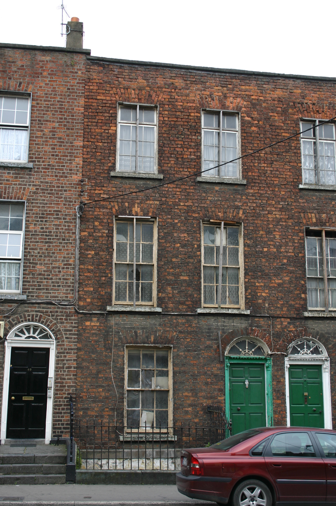
Terraced two-bay three-storey over basement red brick house, built c. 1840, forming one of two houses, built as a pair within a streetscape of varied late Georgian house types. Return abutting No. 51 to the rear. Roof concealed behind parapet wall, with possibly original chimneystack to the south party wall, re-rendered c. 2000. Red brick walls laid in Flemish bond, with original pointing. Limestone coping to parapet wall. Painted rendered basement elevation terminating at ground floor level with a chamfered limestone plinth course. Square-headed window openings, red brick flat arches, rendered reveals, only partially extant, limestone sills, and original six-over-six timber sash windows to basement, ground and first floor level, and timber casement windows to third floor level. Segmental-arched window opening to basement level, painted brick arch and reveals, limestone sill, and original six-over-six timber sash window set in partially exposed sash box. Cylinder and crown glass surviving. Round-arch door opening on limestone threshold, with red brick arch, patent rendered reveals, only partially intact, and doorcase comprising one quarter Ionic engaged columns on limestone blocks, joined by diminutive modillion cornice lintel, with original raised and fielded panelled timber door leaf and original lead detailed web fanlight above. Opens onto shared limestone-paved front door platform arrived at by a flight of limestone steps from pavement, with painted stone plinth wall to north supporting plain wrought-iron railings, with remains of cast-iron rail post, and returning northwards to enclose front site basement area. Narrow lane to rear gives access to a rubble limestone two-storey coach house, which faces the side elevation of the former Quaker meeting house.
This official record and map point do not grant access. Most recorded buildings are privately owned; view them only from public ground unless the owner allows entry.