Add your own picture and explain the route, parking, gates, paths or landmarks that help people find it.
Earn 5 points after the picture is checked and accepted.
Add your photo and local directionsShare what you foundWhat is recorded here
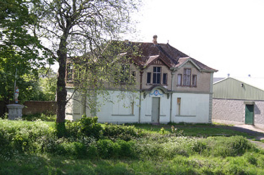
Detached three-bay two-storey clubhouse, built between 1923-24, with two-storey three-sided canted bay window to west-facing side elevation. Hipped fibre cement tiled roof with clay ridge tiles with finials and octagonal vent or chimney flues. Plain timber bargeboards to dormer gables with timber finials. Smooth rendered walls at ground floor level rusticated quoins and moulded stucco stringcourse at first floor level above which the walls are faced in pebbledash render with smooth rendered corner piers. Square-headed window openings, now boarded-up at ground floor level, at first floor level forming half dormers with a tripartite arrangement of central opening flanked by diminutive sidelights, with painted sills, and possible metal-framed windows. Square-headed door opening with boarded-up sidelights having painted sills. Stucco canopy supported on brackets forming a round-arch to centre. Plaque over door with flanking swags. Located adjacent to the Abbey River. Enclosed from street by a squared and coursed limestone wall and plinth wall with wrought-iron railings, either side of tooled limestone ashlar piers and wrought-iron gates with figurative plaques depicting scenes of Limerick. Monument on site with painted figurative statue. Poured concrete slipway to river. Modern structure located to rear, c. 2000.
This official record and map point do not grant access. Most recorded buildings are privately owned; view them only from public ground unless the owner allows entry.