Add your own picture and explain the route, parking, gates, paths or landmarks that help people find it.
Earn 5 points after the picture is checked and accepted.
Add your photo and local directionsShare what you foundWhat is recorded here
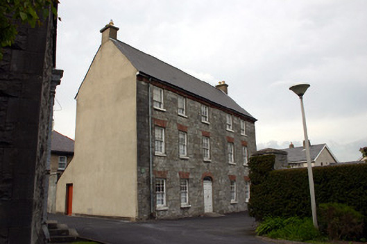
Detached five-bay three-storey limestone parochial house, built c. 1710, with a two-storey three-bay return to the rear, erected c. 1800. Pitched artificial slate roof with rendered chimneystack to apex of gables. Cast-iron rainwater goods. First three-bays of façade faced in squared and snecked limestone, with squared and coursed limestone to the two end bays. Red brick dog-tooth eaves course, introduced c. 1880. Cement rendered gabled side elevation to south and rear elevation, which are without any fenestration. Squared and coursed limestone northeast gable elevation with cement render to apex of gable. Square-headed window openings, one round-arched to side elevation, with handmade red brick flat arches, block-and-start reveals, limestone sills and replacement six-over-six timber sash windows, 1989. uPVC windows to the return. Elliptical-arched door opening with red brick arch, cement rendered reveals, and replacement timber doorcase with double-leaf doors and glazed fanlight. Bas relief plaque over front door representing the Arthur coat of arms. Very much modified interior. A mid eighteenth-century staircase with open thread swan neck balustrade with double Doric newels on pear shaped bases at the landing junctions. Trace of former arch on façade removed, c. 1960. One remaining gate pier, of eighteenth-century origins.
This official record and map point do not grant access. Most recorded buildings are privately owned; view them only from public ground unless the owner allows entry.