Add your own picture and explain the route, parking, gates, paths or landmarks that help people find it.
Earn 5 points after the picture is checked and accepted.
Add your photo and local directionsShare what you foundWhat is recorded here
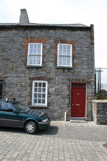
End-of-terrace two-bay two-storey exposed rubble limestone former almshouse, built c. 1760, with an accretion to the rear, c. 2000. Pitched artificial slate roof with cast-iron rainwater goods. Rendered chimneystack with plain clay pots. Roof light to rear span. Squared rubble limestone walls to front, side and rear elevation, with red brick block-and-start quoins to rear corner and localised infill to side elevation. Camber-arched window openings, hand-made red brick flat arches, block-and-start reveals, limestone sills, exposed timber sash boxes and replacement six-over-six timber sash windows. One round-arch window opening to side elevation with red brick arch, squared off by a timber lintel, two-over-two timber sash window, c. 1990. Square-headed door opening with red brick flat arch, block-and-start reveals, replacement raised and fielded panelled timber door leaf, and frosted glass overlight. Facing onto Church Street and a small yard to the rear is enclosed by a rubble limestone wall to side and rear, raised to side elevation with concrete block wall forming external wall of extension. Adjacent to grounds of the Saint Munchin’s Church of Ireland church.
This official record and map point do not grant access. Most recorded buildings are privately owned; view them only from public ground unless the owner allows entry.