Add your own picture and explain the route, parking, gates, paths or landmarks that help people find it.
Earn 5 points after the picture is checked and accepted.
Add your photo and local directionsShare what you foundWhat is recorded here
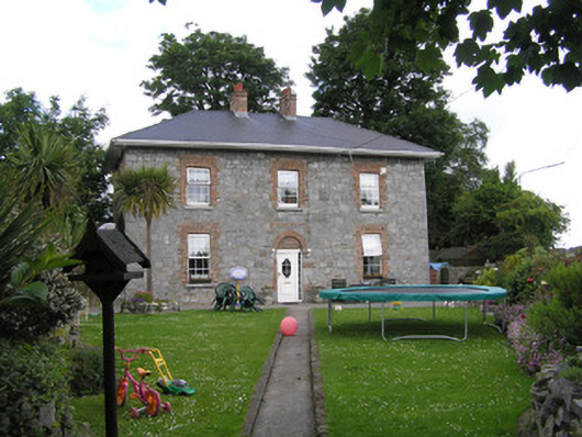
Detached three-bay two-storey corner-sited exposed rubble limestone former constabularly barracks, built c. 1852, facing south on a triangular site forming the junction between the Mill Road and Corbally Road. Now in use as a domestic house. Hipped artificial slate roof with two red brick chimneystacks and uPVC rainwater goods on uPVC overhanging eaves. Coursed and squared rubble limestone walls with cement pointing, cement rendered walls to rear and side elevations. Camber-headed window openings with ganged red brick flat arches and reveals, uPVC windows and limestone sills. Round-headed central front door opening with bricked-up red brick arch, and flush brick label above; replacement uPVC door. Liscannor stone immediate front site enclosed by rubble limestone wall with two piers and wrought-iron gate and pedestrian gate, to apex of triangular site. Further modern steel pedestrian gate on two piers to Corbally Road. Pair of sheet iron gates to Mill Road giving vehicular access to rear.
This official record and map point do not grant access. Most recorded buildings are privately owned; view them only from public ground unless the owner allows entry.