Add your own picture and explain the route, parking, gates, paths or landmarks that help people find it.
Earn 5 points after the picture is checked and accepted.
Add your photo and local directionsShare what you foundWhat is recorded here
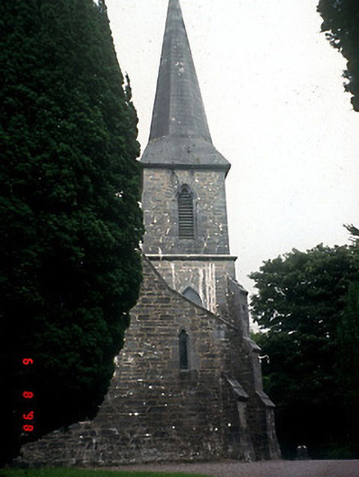
Freestanding double-height Gothic Revival style Church of Ireland church, dated 1858, with five-bay side elevation, three-bay single-storey lean-to aisle to north, single-bay two-stage entrance tower to south-west on a square plan with diagonal stepped buttresses and limestone ashlar hexagonal broach spire, single-bay double-height lower chancel to east gable end having two-bay single-storey vestry projection to north-east. Pitched slate roof with clay decorative ridge comb, gable parapets with limestone copings and coved springers, replacement gutter on limestone brackets and hexagonal ashlar spire with wind vane. Random rubble limestone walls with diagonal corner buttresses and cut-stone dressings. Paired lancets to trefoil heads to nave and aisle with limestone ashlar surrounds. Two lancets to west wall with hexafoil over. Triple lancet east window. Triple-sided openings to second stage of tower. Hood moulding to doorway with limestone steps. Open scissor trussed roof to nave interior. Steps to chancel and pointed chancel arch of limestone ashlar. North aisle with three-bay arcade of limestone columns. Diamond leaded glazed panels to windows with coloured glass margins. Hexagonal Gothic Revival style font. Gateway, built c. 1860, to west comprising pair of limestone ashlar panelled piers with cast-iron gates.
This official record and map point do not grant access. Most recorded buildings are privately owned; view them only from public ground unless the owner allows entry.