Add your own picture and explain the route, parking, gates, paths or landmarks that help people find it.
Earn 5 points after the picture is checked and accepted.
Add your photo and local directionsShare what you foundWhat is recorded here
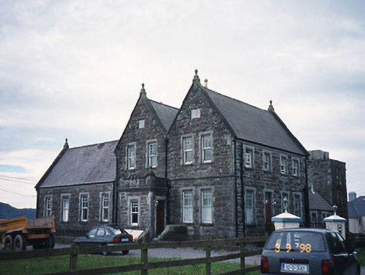
Detached eight-bay single- and two-storey over basement former cable station, dated 1899, comprising four-bay two-storey double-gable-fronted main block with single-bay single-storey flat-roofed projecting porch to ground floor approached by flight of steps. Four-bay side elevations having four-bay single-storey over raised basement wing to south. Two-bay single-storey return to rear to west. Subsequently in use as cable station. Later in use as hostel. Now in use as apartments. Pitched slate roof with clay ridge tiles, gable copings with finials, cast-iron profiled gutters and square downpipes and rubble chimneystacks with ashlar cornices. Rock-hewn random rubble red sandstone walls with grey limestone string courses, springers and parapet copings. Limestone lintels, sills and reveals to timber sliding sash windows having progressively subdivided sliding sash windows at ground floor and first floor. Double-leaf panelled doors approached by granite steps. Retaining interior features. Freestanding single-bay three-stage sandstone water tower, built c. 1900, to west on a square plan with round-headed integral carriage arch to ground floor to house fire engine, now disused and mostly derelict. Freestanding monolithic pier with pyramidal capping having wrought-iron gas lamp holder and wall-mounted cast-iron letter box, c. 1905, with inscribed "ER" monogram.
This official record and map point do not grant access. Most recorded buildings are privately owned; view them only from public ground unless the owner allows entry.