Add your own picture and explain the route, parking, gates, paths or landmarks that help people find it.
Earn 5 points after the picture is checked and accepted.
Add your photo and local directionsShare what you foundWhat is recorded here
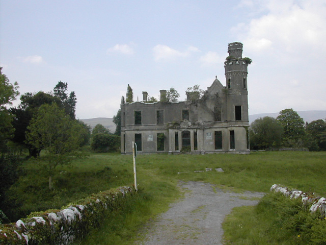
Detached square-plan five-bay two-storey Baronial style house, built 1847, possibly partly over basement. Comprising five-bay two-storey entrance front to south originally with gablets over first floor window openings, single-bay single-storey flat-roofed advanced porch to centre approached by flight of steps, single-bay two-storey gabled advanced bay to right, single-bay three-storey battlemented corner tower to south-east on a circular plan and single-bay three-storey corbelled circular turret to east. Five-bay two-storey side elevation to east with two-bay two-storey gabled advanced end bay to north-east. Four-bay two-storey side elevation to west with single-bay two-storey gabled end bay to south-west having two-storey gabled box bay window. Five-bay two-storey garden front to north possibly partly over basement. Burnt, 1921, now ruinous. Roof now gone. Ruled-and-lined rendered walls with raised render quoins, limestone string courses at sills and parapet, stepped parapet with finials and rendered chimneystacks. Raised render surrounds and keystones to openings with apron panels to first floor windows. Two-storey gabled oriel to west with limestone mullions. Mullioned windows to east. Tripartite doorcase with swept-arched doorway flanked by sidelights and approached by limestone steps. Detached five-bay single-storey outbuilding with half-dormer attic, built c. 1850, to north-west, extensively renovated, with openings remodelled and possibly with dormer attic added to accommodate residential use. Remains of rubble stone-built walled enclosure to north with series of segmental-headed carriage arches. Remains of detached ten-bay single-storey rubble stone-built outbuilding, built c. 1850, to north-east, now ruinous. Built on site of medieval abbey, castle and towers.
This official record and map point do not grant access. Most recorded buildings are privately owned; view them only from public ground unless the owner allows entry.