Add your own picture and explain the route, parking, gates, paths or landmarks that help people find it.
Earn 5 points after the picture is checked and accepted.
Add your photo and local directionsShare what you foundWhat is recorded here
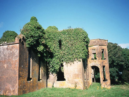
Detached seven-bay two-storey house, built c. 1840, incorporating fabric of earlier building to north. Comprising three-bay two-storey projecting bay to centre on a half-octagonal plan with two-bay double-height gable-fronted recessed end bays to east and to west. Two-bay side elevations. End bay to east originally in use as private chapel. Five-bay rear elevation to north having two-bay two-storey return with single-bay two-storey block at right angles to north. In use, pre-1934, now ruinous. Rendered rubble stone walls with parapet wall to projecting bay. Flat-headed openings with timber lintels, lead trays below two first floors, sills now removed. Facetted central two-storey bay to facade apparently with doors to each side. East doorway with outline of pediment over west doorway with plinth. Detached five-bay two-storey rubble stone-built outbuilding, built c. 1840, to north-west, now derelict. Detached five-bay two-storey rubble stone-built outbuilding, built c. 1840, to north-west with round-headed integral carriage arch and single-bay single-storey lean-to projecting bay to centre, now ruinous. Detached eight-bay two-storey rubble stone-built outbuilding, built c. 1840, to north-west with lancet arch openings, now ruinous. Remains of rubble stone-built walled garden, built c. 1840. Gateway, built c. 1840, to south-east comprising pair of cast-iron piers with cast-iron gates.
This official record and map point do not grant access. Most recorded buildings are privately owned; view them only from public ground unless the owner allows entry.