Add your own picture and explain the route, parking, gates, paths or landmarks that help people find it.
Earn 5 points after the picture is checked and accepted.
Add your photo and local directionsShare what you foundWhat is recorded here
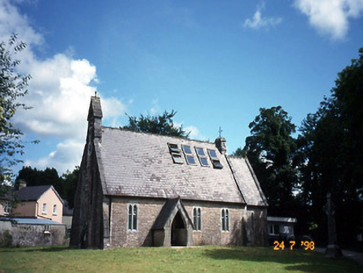
Freestanding double-height Gothic Revival former Church of Ireland church, built c. 1870, with single-bay single-storey gabled projecting open porch to south elevation and single-bay double-height lower chancel to east gable end. Renovated and extended in late twentieth century, with dormer attic added, two-bay single-storey flat-roofed projecting bay added to north elevation and two-bay single-storey flat-roofed projecting bay added to east gable end to accommodate use as youth centre. Pitched slate roofs, lower chancel roof, with gable limestone copings, gabled bell-cote to west front and cast-iron gutters and downpipes. Ridge-comb roof lights inserted. Rubble stone walls with cement repointing, buttresses to centre and sides of west gable with ashlar haunching. Paired lancets with limestone surrounds, leaded diamond quarry glazing. Trefoil to west gable. Original double-leaf Gothic Revival doors with tiled floor to porch. Many details of church interior are retained including scissor roof trusses on limestone corbels, brass wall memorial, carved timber reredos, limestone chancel steps, aisle and chancel floor tiles and section of altar rail. Freestanding cut-stone Celtic Cross style grave marker, c. 1900, to site. Gateway, built c. 1870, to south-west comprising pair of cut-stone piers with triangular capping having cast-iron gates. Rubble boundary wall with stone-on-edge-coping.
This official record and map point do not grant access. Most recorded buildings are privately owned; view them only from public ground unless the owner allows entry.