Add your own picture and explain the route, parking, gates, paths or landmarks that help people find it.
Earn 5 points after the picture is checked and accepted.
Add your photo and local directionsShare what you foundWhat is recorded here
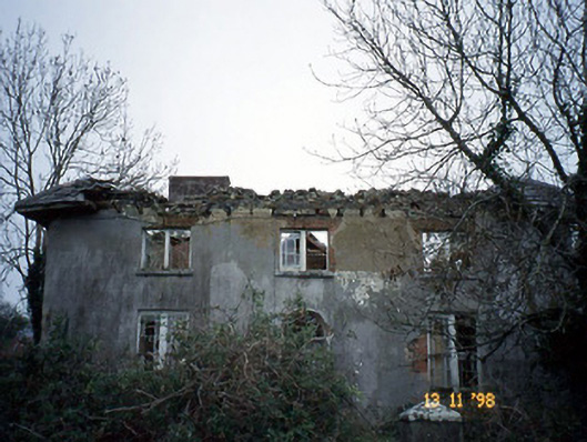
Detached three-bay two-storey house, built c. 1840, with single-bay two-storey return to north-west having two-bay two-storey lean-to lower bay to south-west. Now ruinous. Pitched slate roof with clay ridge tiles, overhanging eaves, timber brackets and red brick chimneystack. Rendered rubble stone walls. Round-headed door opening with fanlight to centre. Bipartite window openings with limestone sills, red brick flat arches, timber sliding sash windows with margin lights and timber casement windows. Attached two-bay single-storey rubble stone-built outbuilding to north-west with single-bay single-storey lean-to projecting linking bay. Detached six-bay single-storey rubble stone-built outbuilding, built c. 1840, to north-west on a stepped plan. Remains of rubble stone-built walled orchard to site. Gateway, built c. 1840, to south-west comprising monolithic stone pier with cast-iron gate. Farmyard to west with stone paving, house built in north-west corner.
This official record and map point do not grant access. Most recorded buildings are privately owned; view them only from public ground unless the owner allows entry.