Add your own picture and explain the route, parking, gates, paths or landmarks that help people find it.
Earn 5 points after the picture is checked and accepted.
Add your photo and local directionsShare what you foundWhat is recorded here
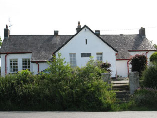
Detached T-plan eight-bay single-storey former national school, dated 1934, now in use as house. Central projecting gable-fronted bay to front (west) with flanking lean-to porches and lean-to extension to rear (east). Pitched slate roofs having rendered chimneystacks, louvered wrought-iron ventilation monitors and cast-iron rainwater goods. Rendered walls with carved stone date plaque to front elevation. Square-headed window openings with stone sills throughout, having six-over-six and four-over-four pane timber sliding sash windows. Square-headed door openings, having glazed timber doors to side (north) elevations of projecting bay and porch. Associated outbuilding and rubble stone separating wall to rear dividing former play ground. Rendered square-profile gate piers to front with concrete stepped approach. Set within own grounds.
This official record and map point do not grant access. Most recorded buildings are privately owned; view them only from public ground unless the owner allows entry.