Add your own picture and explain the route, parking, gates, paths or landmarks that help people find it.
Earn 5 points after the picture is checked and accepted.
Add your photo and local directionsShare what you foundWhat is recorded here
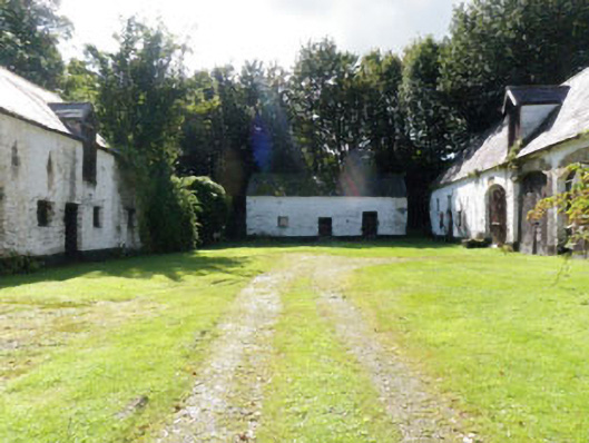
Farmyard complex, built c.1800, associated with Kilmaloda House. Rectangular-plan yard surrounded by single- and two-storey outbuildings. Range of derelict and ruinous single and two-storey outbuildings to southwest of yard. Single-storey with dormer attic block to west of yard, two-storey block to south of yard, partially collapsed to southern end. Single-storey with dormer attic block to east of yard, having central integral carriage arch and remains of rubble stone extension to interior (west) elevation. Two-storey block to north of yard. Single- and two-storey blocks to south-western range. Pitched slate roofs with stone eaves courses throughout complex, some missing to south-west range. Cast-iron rainwater goods to south, north and east blocks of courtyard and northern block of south-west range. Rubble stone walls throughout. White washed rubble stone wall with rendered plinth band to inward facing elevations of blocks surrounding yard. Square-headed window openings with timber and dressed limestone lintels throughout complex. Five-over-two and four-over-four pane timber sliding sash windows to north block. Fixed timber framed cast-iron quarry-glazed windows to first floor of north block. Fixed timber-framed windows, to west, south and east blocks of courtyard, north block of south-west range. Square-headed door openings throughout, with timber lintels and timber battened doors. Dressed stone lintel to east block and north block of south-western range. Segmental-headed carriage arch to east block with dressed stone voussoirs to west elevation, ashlar limestone voussoirs with keystone to east elevation and white-washed rubble stone soffit. Segmental-headed carriageway openings with dressed stone voussoirs to north block, having timber battened doors. Three elliptical-headed carriageway openings with dressed stone voussoirs to front (east) elevation of central block of south-west range.
This official record and map point do not grant access. Most recorded buildings are privately owned; view them only from public ground unless the owner allows entry.