Add your own picture and explain the route, parking, gates, paths or landmarks that help people find it.
Earn 5 points after the picture is checked and accepted.
Add your photo and local directionsShare what you foundWhat is recorded here
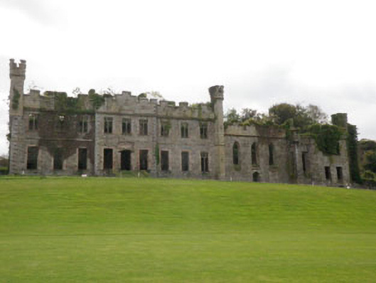
Detached nine-bay two-storey over basement country house, built 1798, attached to medieval tower house, Gothicised and extended c.1870. Three-bay two-storey central breakfront to front (north), with square-profile and octagonal-profile turrets to end corners, and having full-height bow to rear (south). Range of blocks to side (west), comprising three-bay two-storey extension with two-storey projection to front (north) and rear (south). Partially collapsed tapered three-stage tower to centre, having extension to west end. Now ruinous. Rubble stone walls throughout, with exception of ashlar stone wall to front turret. Random coursed rubble stone parapet walls to front and side (east) elevations of main block, breakfront, east extension of west range and central tower of east range. Crow-stepped crenellated parapet walls with splayed ashlar stone capping, on ashlar stone cornice with block modillions throughout having arrow-loops, balistrariae, heraldic devices and stepped cornices. Chamfered rusticated ashlar limestone quoins to main block and breakfront. Rubble stone plinth with chamfered ashlar stone coping to front and side (east) elevations of main block and to breakfront. Random coursed rubble stone plinth with broaches to front turret. Random coursed rubble stone buttresses with splayed ashlar stone capping to projection of west range, and to front (north) elevation of west extension to west range. Square-headed window openings throughout with limestone sills, having rendered brick reveals, rendered block-and-start brick surrounds and rendered label-mouldings to main block, breakfront and rear bow projection, incorporating chamfered rendered panel-tracery with paired ogee-headed lancets. Window openings with dressed stone voussoirs to front and rear projections to east extension of west range. Ashlar limestone sills on moulded modillions to opening to first floor to side (west) elevation of rear projection. Splayed reveals to front (north) elevation of front projection. Timber frame window to side (west) elevation of front projection of east extension of west range, incorporating moulded mullions and transoms. Round-headed window opening with limestone sill to side (east) elevation of main block, incorporating chamfered Y-tracery. Camber-headed window openings with brick voussoirs to basement of main block. Pointed arch window openings with splayed ashlar stone sills on moulded ashlar stone corbels to front (north) elevation of east extension of west range, having splayed reveals and dressed stone voussoirs. Four-centred arch window opening with stone sill and dressed stone voussoirs to front (north) elevation of west extension of west range. Square-headed door openings throughout. Perron having rendered side walls with moulded pointed trefoil arch panelled band to front elevation. Ashlar limestone chamfered reveals and block-and-start surround to east end to rear elevation of main block. Four-centred arch door opening with dressed stone voussoirs to front (north) elevation of east extension of west range. Rubble stone boundary walls. Landscaped garden to south with pond. Remains of courtyard to west with outbuildings.
This official record and map point do not grant access. Most recorded buildings are privately owned; view them only from public ground unless the owner allows entry.