Add your own picture and explain the route, parking, gates, paths or landmarks that help people find it.
Earn 5 points after the picture is checked and accepted.
Add your photo and local directionsShare what you foundWhat is recorded here
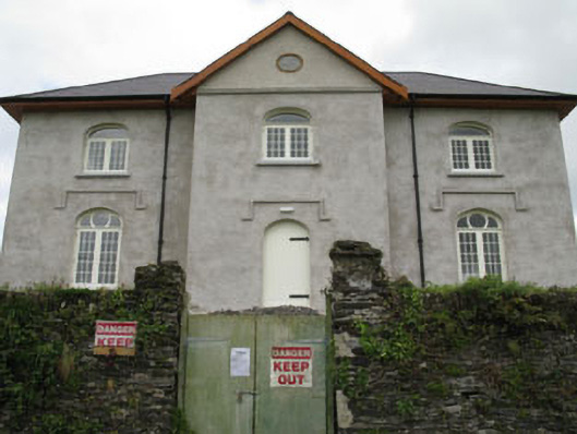
Detached three-bay two-storey school, built c.1840, having central gabled breakfront bay to front (west) elevation and external staircase to south, leading to first floor door set in rear elevation. Recently renovated and currently vacant. Hipped and pitched slate roofs having rendered chimneystack, overhanging timber clad eaves and cast-iron rainwater goods. Roughcast rendered walls with platband to base of breakfront. Carved limestone name plaque to gable of breakfront having red brick surround. Round-headed window openings with limestone sills to first floor of front elevation having replacement timber casement windows and fixed single-pane overlights. Pointed arch window openings with render label mouldings and limestone sills to ground floor front of elevation having replacement timber casement windows with fixed three-pane overlights. Square-headed window openings with stone sills to rear (east) and side (north, south) elevations having timber casement windows. Round-headed door opening with render label moulding to front elevation having timber battened door. Square-headed door opening to side (north) elevation having timber battened door and overlight. Square-headed door opening to first floor of rear elevation having timber battened door with rubble stone and concrete stairwell. Ruinous remains of outbuilding to south. Rubble stone boundary wall to front with gate piers. Set within own grounds.
This official record and map point do not grant access. Most recorded buildings are privately owned; view them only from public ground unless the owner allows entry.