Add your own picture and explain the route, parking, gates, paths or landmarks that help people find it.
Earn 5 points after the picture is checked and accepted.
Add your photo and local directionsShare what you foundWhat is recorded here
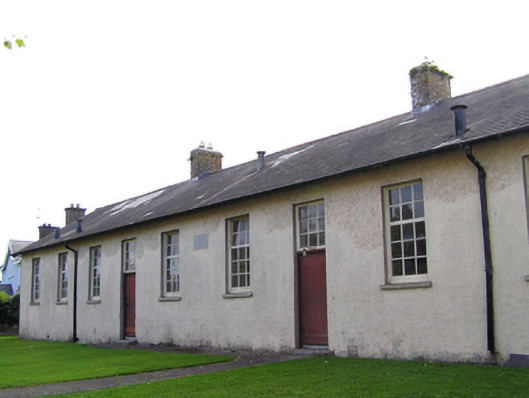
Detached ten-bay single-storey former school, dated 1891, now disused. Pitched artificial slate roof with brick chimneystacks. Roughcast rendered walls to front (east) elevation, smooth rendered walls to other elevations, date stone to front elevation. Square-headed openings throughout, having six-pane pivoting over nine-pane fixed windows with limestone sills, and timber battened doors with nine-pane square overlights, with limestone steps to front elevation. Rendered boundary wall with wrought-iron pedestrian gate to front boundary, small stream and rubble stone wall to front of front boundary. Lean-to outbuildings to rear of site, incorporated into rendered boundary wall with rubble stone vertical coping stones, and flanked by two pairs of square-profile cut stone piers with wrought-iron double-leaf gates.
This official record and map point do not grant access. Most recorded buildings are privately owned; view them only from public ground unless the owner allows entry.