Add your own picture and explain the route, parking, gates, paths or landmarks that help people find it.
Earn 5 points after the picture is checked and accepted.
Add your photo and local directionsShare what you foundWhat is recorded here
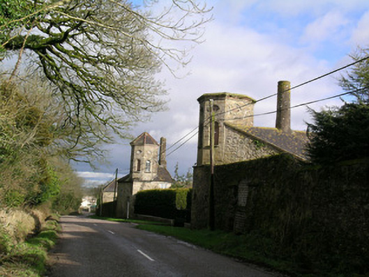
Two-storey outbuilding, built c. 1750, to west side of courtyard to rear, north, side of country house. Pitched slate roof, having rendered round-plan chimneystacks towards north, road, end, with string course near top. Two-stage octagonal-plan turret over north end of building, with moulded string course, and eaves courses. Pediment over front elevation of building, over paired vehicular entrance bays, flanked by carved finials and standing forward of stone bellcote with round-headed bell opening with imposts. Random rubble sandstone walls to main part of building and coursed dressed sandstone to turret. Round, oval and some diamond-shaped windows to first floor of front, east, elevation of building, with raised stone surrounds with keystones, and voussoirs at quarter positions. Some round-headed pitching doors to first floor. Ground floor has elliptical-arched vehicular entrances with brick voussoirs and stone keystones. Round-headed niche between arches and to first floor above, having brick dressings and stone hood-mouldings and keystones. Round-headed window and door openings elsewhere to ground floor, with hood-mouldings having keystones and plain block stops. Openings to first floor lie directly over those to ground floor. Round-headed windows to first stage of turret, with moulded stone hood-mouldings having plain block stops and triple keystones and stone sills. Oeil-de-boeuf windows to top stage, with moudled stone surrounds. Ogee-headed openings to ground floor of building at north end. North wall continues to west and has blocked segmental-arched gateway with slightly projecting piers. Similar turret to outbuilding to east side of courtyard, with rendered plinth wall between, with cast-iron railings and cast-iron double-leaf vehicular gate.
This official record and map point do not grant access. Most recorded buildings are privately owned; view them only from public ground unless the owner allows entry.