Add your own picture and explain the route, parking, gates, paths or landmarks that help people find it.
Earn 5 points after the picture is checked and accepted.
Add your photo and local directionsShare what you foundWhat is recorded here
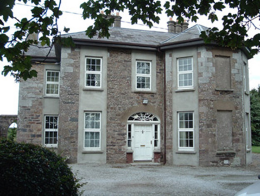
Detached irregular-plan two-storey house, built c. 1820, facing west and having three-bay elevations. Plan essentially square, with canted bay to south end of front elevation and middle of south elevation, and having one-bay projections to north and east elevations. Recent single-storey lean-to extension to north-east angle. Slate roof, hipped skirt to main part and pitched to projections. Rendered chimneystacks, having triple octagonal chimneys to main part of building, and replacement timber eaves boards. Coursed sandstone rubble walls, with tooled limestone quoins, rendered to gable of east projection and to form full-height panels to windows of each bay. Smooth rendered façades to rear and north. Square-headed window openings, blind to centre of south-west canted bay, all with replacement uPVC windows. Segmental-headed entrance opening having timber panelled door with spoked fanlight and having two-over-one pane timber sliding sash sidelights with brick risers and having cylinder glass panes to upper sashes. House fronts onto gravel drive, and garden. Yard to rear of house accessed through pointed arch entrance with dressed sandstone voussoirs in rubble sandstone wall. Sweeping entrance gateway having roughcast rendered walls terminating in rectangular-plan smooth-rendered piers with rough-cast panels, and double-leaf wrought-iron gates.
This official record and map point do not grant access. Most recorded buildings are privately owned; view them only from public ground unless the owner allows entry.