Add your own picture and explain the route, parking, gates, paths or landmarks that help people find it.
Earn 5 points after the picture is checked and accepted.
Add your photo and local directionsShare what you foundWhat is recorded here
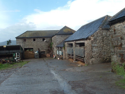
Outbuildings to rear, north-west and west of Longueville House, built c. 1750, having mainly slate roofs and coursed rubble limestone and sandstone walls, and walled garden built 1829 to west of house. North-west courtyard comprises attached L-shaped two-storey four-bay north block and three-bay two-storey west block, with hipped roof and square-headed window openings having brick surrounds and some timber battened doors, flat-arched vehicular entrance to east wall of western section and elliptical-arched vehicular entrance to west side having red brick voussoirs. Two-bay single-storey projection to south with hipped roof and three-bay single-storey lean-to projection to north end of west elevation having corrugated-iron roof and some loop openings. Two-bay single-storey building with pitched roof attached to east of L-shaped range, with two-bay single-storey building with pitched and half-hipped roof attached to eastern end. North-east range of yard comprises three attached single-storey structures, stepped into natural slope, comprising two-bay eastern building and three-bay central building having pitched roofs, with square-headed dove-roost openings to exposed verge of gables. Half of round-headed door opening to centre and square-headed door opening with brick surround to west of centre of building having timber battened doors. Two-bay single-storey building to west with pitched and hipped roof. Eastern range of yard formed by western range of eastern yard. Southern range comprises four-bay two-storey building, with pitched corrugated-iron roof and coursed stone walls. Two-bay single-storey building attached to west having pitched roof, coursed stone walls and elliptical-arched vehicular entrances having red-brick voussoirs. Remainder of southern boundary formed by north wall of western walled garden. Yard divided in two by attached single-storey building with corrugated-iron barrel-roof and coursed rubble stone walls. Detached recent lean-to hay shed to west. Detached recent farm buildings to north-west of western yard, having coursed rubble stone walls to walled garden having red-brick facing to south side. Canted gazebo to north having hipped shingle roof and red-brick walls, with square-headed openings.
This official record and map point do not grant access. Most recorded buildings are privately owned; view them only from public ground unless the owner allows entry.