Add your own picture and explain the route, parking, gates, paths or landmarks that help people find it.
Earn 5 points after the picture is checked and accepted.
Add your photo and local directionsShare what you foundWhat is recorded here
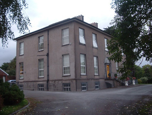
Detached five-bay two-storey over half-basement country house, built c. 1800, facing south. Hipped slate overhanging roof having rendered chimneystacks. Rendered walls having render plinth course and render eaves course with projecting timber eaves. Square-headed window openings having some limestone sills. Mainly replacement uPVC windows, with some timber sliding sash windows to rear and east elevation, six-over-six pane to first floor and nine-over-six pane to ground floor, with replacement timber windows to basement. Round-headed window opening to rear having nine-over-six pane timber sliding sash window with batwing fanlight. Oval window opening below round-headed window, having spoked frame. Round-headed carved limestone doorcase to main entrance, having timber panelled double-leaf door flanked by engaged columns with fern-leaf capitals and moulded plinths, flanked in turn by sidelights with ornate glazing, all surmounted by cornice, moulded to doorway and with guilloche pattern over sidelights, and with ornate batwing fanlight above. Approached by flight of limestone steps with replacement metal railings. Curved entrance gateway over disused canal, having rendererd walls with tooled limestone copings and square-plan ashlar limestone piers with wrought-iron double-leaf vehicular gates and pedestrian gates. House name incised on vehicular piers.
This official record and map point do not grant access. Most recorded buildings are privately owned; view them only from public ground unless the owner allows entry.