Add your own picture and explain the route, parking, gates, paths or landmarks that help people find it.
Earn 5 points after the picture is checked and accepted.
Add your photo and local directionsShare what you foundWhat is recorded here
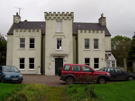
Detached five-bay two storey house, built c. 1780, with square-plan embattled projections c. 1860 to front elevation, middle entrance projection being single-bay and three-storey and end projections being two-bay and two-storey, and having two-storey lean-to addition to full length of rear elevation, with later pitched roof extension. Pitched slate roof to main block with rendered gable-end chimneystacks having cast-iron rainwater goods, front elevation having square-profile downpipes having gargoyle hopper heads and gutters having lions' head masks. Painted smooth rendered walls. Square-headed window openings throughout having timber one-over-one pane timber sliding sash windows, having replacement uPVC windows to entrance projection and to rear elevation. Rendered label-moulding to first floor window of entrance projection. Square-headed entrance doorway with moulded render cornice supported on brackets, having timber panelled door with leaded glazing. U-plan farmyard to rear enclosed by three ranges of farm buildings, north range being two-storey and having pitching door with gablet reached by flight of steps to front elevation, other buildings being single-storey, with pitched and lean-to slate roofs and painted rubble stone walls. Ruined medieval tower house incorporated into north-east corner of yard. Cast-iron water pump in yard. Entrance to south-west with rendered piers connected by rendered curving walls.
This official record and map point do not grant access. Most recorded buildings are privately owned; view them only from public ground unless the owner allows entry.