Add your own picture and explain the route, parking, gates, paths or landmarks that help people find it.
Earn 5 points after the picture is checked and accepted.
Add your photo and local directionsShare what you foundWhat is recorded here
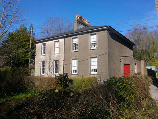
Pair of semi-detached two-bay two-storey over basement houses, built c.1830, with flat-roofed porches to side elevations and advanced end bays to rear. Hipped slate roof with shared rendered corbelled chimneystack having clay pots, cast-iron gutters to projecting timber battened eaves and cast-iron downpipes. Roughcast rendered walls with smooth-rendered raised plinth, smooth-rendered walls to north elevation. Cast-iron cover at ground level east elevation, eastern house. Square-headed window openings with smooth-rendered surrounds, stone sills and six-over-six timber sash windows. Round-headed window openings to north elevations with timber sash windows. Square-headed door openings to south elevations of porches, accessed via cut-stone limestone steps, timber doors with decorative door furniture, moulded render surround comprising pilasters supporting entablature to western house. Replacement railings to basement area. Houses set facing south at western end of cul-de sac, rear gardens bounded by random rubble stone walls with render coping.
This official record and map point do not grant access. Most recorded buildings are privately owned; view them only from public ground unless the owner allows entry.