Add your own picture and explain the route, parking, gates, paths or landmarks that help people find it.
Earn 5 points after the picture is checked and accepted.
Add your photo and local directionsShare what you foundWhat is recorded here
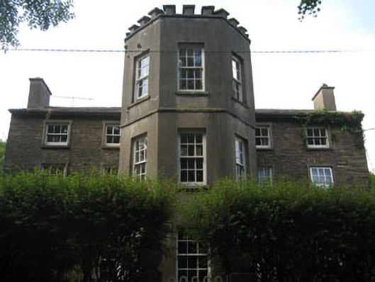
Detached double-pile five-bay three-storey over basement house, built c.1780, incorporating fabric of earlier building c.1685, and having late three-bay three-storey canted bay addition to front (north-east) elevation, c.1850. Pitched slate roofs with rendered chimneystacks, stone eaves course and uPVC rainwater goods. Rubble stone and rendered walls, having rendered crenellated parapet wall to canted bay with rendered capping. Diminishing square-headed window openings with render sills, having raised render surrounds and rubble stone voussoirs. Six-over-six pane timber sliding sash windows to first and ground floors, having replacement six-over-six pane timber casement windows to western end of ground floor to front elevation. Three-over-three pane timber sliding sash windows to second floor. Six-over-six pane timber sliding sash windows to canted bay, having blind window openings to first and second floors of side (north-west, south-east) elevations. Single stone sill to ground floor window of front elevation. Square-headed door openings with replacement uPVC doorcases to canted front addition, having uPVC doors. Retaining interior features. Rubble stone outbuilding to north, in use as pottery. Rubble stone boundary wall to roadside (north, north-east). Located on the outskirts of the village with low lying grounds to the rear traversed by stream.
This official record and map point do not grant access. Most recorded buildings are privately owned; view them only from public ground unless the owner allows entry.