Add your own picture and explain the route, parking, gates, paths or landmarks that help people find it.
Earn 5 points after the picture is checked and accepted.
Add your photo and local directionsShare what you foundWhat is recorded here
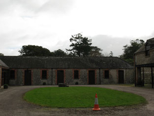
Detached H-plan farmyard complex, built c.1845, comprising single-storey multiple-bay ranges to north and east and two-storey range to south. Ranges to east block not accessible. Hipped and pitched slate roofs, red brick chimneystacks, eaves course and cast-iron rainwater goods. Timber cupola to eastern range, with clock, pitched slate roof and wrought-iron weather vane. Rubble stone walls with sections of roughcast render. Camber-headed window openings with red brick block-and-start surrounds, voussoirs and stone sills having six-over-six pane timber sliding sash windows. Camber-headed door openings with red brick-block-and-start surrounds, voussoirs and timber battened doors with overlights. Square-headed carriage arch openings to northern range having red brick block-and-start surrounds and replacement timber battened doors. Courtyard areas to south of eastern range having recent gravel surface. Cobblestone drainage gullies to base of walls. Rubble stone enclosing walls to site with segmental-arch-headed carriageway opening to north-east having rough dressed sandstone piers and red brick voussoirs with dated keystone 1843.
This official record and map point do not grant access. Most recorded buildings are privately owned; view them only from public ground unless the owner allows entry.