Add your own picture and explain the route, parking, gates, paths or landmarks that help people find it.
Earn 5 points after the picture is checked and accepted.
Add your photo and local directionsShare what you foundWhat is recorded here
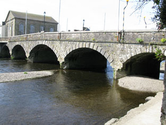
Freestanding five-span road bridge, dated 1773, enlarged 1838, spanning the Bandon River. Splayed arch to southern end of west elevation. Camber-arches increasing in width towards central arch, having alternating raised tooled stone voussoirs, rubble stone soffits springing from tooled limestone block piers with V-cutwaters to east and west elevations. Limestone block and pyramidal render capping to west elevation cutwaters. Dressed limestone walls and spandrels surmounted by tooled limestone cornice and dressed limestone parapets with tooled limestone coping stones. Raised central piers with street lamp to parapets, having tooled stone commemorative plaques to interior walls. Tooled limestone terminal pier to northern end of western parapet. Rubble stone abutments with later rubble stone arched buttress to northern end of west elevation having alternating raised rusticated limestone block voussoirs and rubble stone spandrels surmounted by stone block cornice and low rubble stone parapet wall with convex tooled stone coping. Recent concrete girder bridge perpendicular to south end of side (east) elevation.
This official record and map point do not grant access. Most recorded buildings are privately owned; view them only from public ground unless the owner allows entry.