Add your own picture and explain the route, parking, gates, paths or landmarks that help people find it.
Earn 5 points after the picture is checked and accepted.
Add your photo and local directionsShare what you foundWhat is recorded here
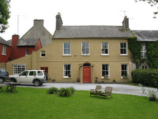
Attached four-bay two-storey house, built c.1860, having porch to front (west) and lean-to additions to side (north). Bowed bay to rear (east). House formed part of Watergate Brewery or Cornwall's Brewery. Pitched artificial slate roof with rendered chimneystacks, eaves course, render gable copings and cast-iron rainwater goods. Felt-lined flat roof to bowed bay. Roughcast rendered walls, having rendered walls to ground floor of front elevation and rear elevation. Rendered walls to porch having tooled stone plinths. Square-headed window openings with tooled limestone and render sills throughout, having internal timber panelled shutter and two-over-two pane timber sliding sash windows to front elevation. Replacement timber casement window to lean-to addition and to rear elevation of house. Stained glass window to northern end of ground floor to rear elevation. Round-headed stairwell window to rear elevation of bowed bay having multi-pane timber casement window. Round-headed window openings to side (north and south) elevations of porch. Bowed timber casement window with decorative rendered cornice to ground floor of front elevation of lean-to addition. Elliptical-headed door opening having paved stone approach, replacement timber doorcase and timber panelled door surmounted by fanlight. Square-headed door opening with double-leaf timber glazed doors to front elevation. Situated within own grounds, enclosed by rendered rubble-stone boundary walls with splayed entrance comprising rendered square-profile piers and pyramidal tooled stone capping.
This official record and map point do not grant access. Most recorded buildings are privately owned; view them only from public ground unless the owner allows entry.