Add your own picture and explain the route, parking, gates, paths or landmarks that help people find it.
Earn 5 points after the picture is checked and accepted.
Add your photo and local directionsShare what you foundWhat is recorded here
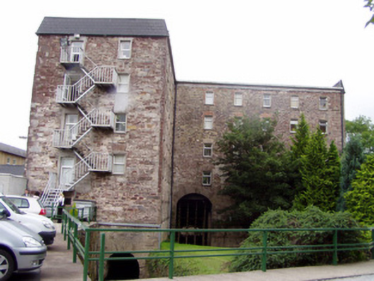
Detached L-plan five-storey former water mill, built 1802, extended in 1840s, reduced in size following fire in 1960s, and now in use as offices, having nine-bay north-south block, with multiple-bay east-west block at right angles. Four and five-bay inner elevations, and two-bay gables. Recent single-storey lean-to extensions to south elevation and to south-west corner, and having fire escape to east gable. Flat roofs with slate-clad veneer to gables and to south elevation. Rubble sandstone walls, with dressed quoins. Square-headed openings with dressed stone jambs and voussoirs, having concrete sills and recent render reveals, with replacement uPVC windows. Recent square-headed openings to north gable with render surround. Round-headed arches in west elevation of north-south block matched by two in east elevation, one in east gable, and marking millraces, arches having cut sandstone voussoirs and jambs, and northern race retaining cast-iron millwheel lacking paddles. Millrace, fed by River Blackwater, has rubble stone walls, with two-arch bridge to front of arches of west elevation.
This official record and map point do not grant access. Most recorded buildings are privately owned; view them only from public ground unless the owner allows entry.