Add your own picture and explain the route, parking, gates, paths or landmarks that help people find it.
Earn 5 points after the picture is checked and accepted.
Add your photo and local directionsShare what you foundWhat is recorded here
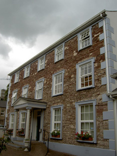
Corner-sited five-bay three-storey former house, built c. 1810, set at right angle to streetscape, and having four-bay return elevation to street. Formerly in use as garda station, now in use as community centre. Portico addition to ground floor front elevation, and three-bay single-storey extension to north, with single-bay single-storey link to main block. Hipped artificial slate roof with rendered chimneystack and render eaves course. Exposed rubble walls to front elevation, and rendered walls to street elevation and to extension. Render quoins and plinth to front and street elevations. Square-headed openings throughout, having shouldered moulded render surrounds, render sills and replacement uPVC windows. Door opening to front elevation has moulded render surround, timber panelled door and ornate spoked overlight. Portico comprising render fluted columns with render architrave, frieze and pediment. Square-headed door opening to street elevation with shouldered moulded render surround and replacement timber door. Site bounded by rendered walls with metal railings and gate.
This official record and map point do not grant access. Most recorded buildings are privately owned; view them only from public ground unless the owner allows entry.