Add your own picture and explain the route, parking, gates, paths or landmarks that help people find it.
Earn 5 points after the picture is checked and accepted.
Add your photo and local directionsShare what you foundWhat is recorded here
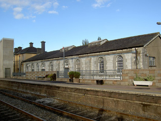
Nine-bay double-height former engine shed, built c. 1845, with single-bay two-storey projection to east. Pitched slate roof to former engine shed with red brick chimneystack and gabled rooflights with timber sides. Rendered walls to main block and its additions. Dressed limestone walls with dressed limestone buttresses dividing bays to west elevation and dividing every second bay to east elevation, east projection having rendered first floor. Square-headed window openings to east elevation set into round-headed recesses with dressed limestone block-and-start surrounds and voussoirs with six-over-six pane timber sliding sash windows with cast-iron protective railings, and continuous carved limestone sill course. Round-headed openings to west elevation with fixed timber windows, protective cast-iron railings, carved limestone continuous sill course and flush dressed limestone voussoirs and block-and-start surrounds. Projection to east has square-headed window openings to east elevation with fixed timber windows and concrete sills. Square-headed door opening to west elevation of main building set into round-headed opening with timber panelled door and dressed limestone lintel, having round-headed fixed timber window above with fanlight. Rubble limestone wall to roadline to front of engine shed, having rounded dressed limestone coping.
This official record and map point do not grant access. Most recorded buildings are privately owned; view them only from public ground unless the owner allows entry.