Add your own picture and explain the route, parking, gates, paths or landmarks that help people find it.
Earn 5 points after the picture is checked and accepted.
Add your photo and local directionsShare what you foundWhat is recorded here
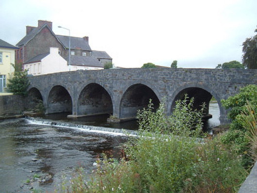
Road bridge over River Dalua, dated 1760, having six round arches, a seventh no longer visible, with cut limestone voussoirs, having raised keystones to north elevation. Walls and parapets of roughly coursed limestone and sandstone, parapets having cut tooled limestone coping. Ashlar limestone V-cutwaters to south elevation. Limestone plaques to both parapet walls, one including date for bridge, second adverting to costs of building bridges in Dublin and London and third bearing poem about river. Weir to north side of bridge. Bridge widened in mid-nineteenth century, formerly having had canopies pedestrian refuges to parapets.
This official record and map point do not grant access. Most recorded buildings are privately owned; view them only from public ground unless the owner allows entry.