Add your own picture and explain the route, parking, gates, paths or landmarks that help people find it.
Earn 5 points after the picture is checked and accepted.
Add your photo and local directionsShare what you foundWhat is recorded here
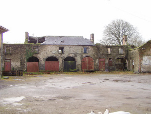
Outbuildings to south-west of Doneraile Court, built c. 1825, comprising eleven-bay two-storey south range with single-storey two-bay projection to north, six-bay single-storey west range and three-bay single-storey north range. Now disused. South range having remains of pitched slate roof with some clay ridge tiles. Coursed limestone rubble walls with some lime render. Red brick cladding to north gable of north projection. Square-headed window openings having limestone sills and some traces of six-over-three pane timber sliding sash windows. Square-headed door openings having peck-dressed voussoirs and timber battened doors. Five round-headed arch openings having peck-dressed voussoirs, with some red brick voussoirs. Having some double-leaf corrugated-iron doors and some double-leaf timber battened doors, one retaining decorative cast-iron hinges. Roofless west range having coursed limestone walls, with gables to north and south. Square-headed window and door openings with inserted iron H-bar lintels and no fittings. Currently being restored. Roofless north range having coursed limestone walls with gables to east and west, square-headed window and door openings with no remaining fittings, currently being restored. Entrance gateway to courtyard comrpises ashlar limestone piers with caps and plinths and having carved limestone finials, with timber battened double-leaf gate.
This official record and map point do not grant access. Most recorded buildings are privately owned; view them only from public ground unless the owner allows entry.